
Pumalin Park - Monument to Conservation Vision
Pumalín Park is Doug Tompkins' original and most personal conservation project—325,000 hectares (800,000 acres) of pristine temperate rainforest donated to Chile in 2017, now a national park bearing his name posthumously.

Los Lagos Region, Chile — Monument to Conservation Vision
Overview
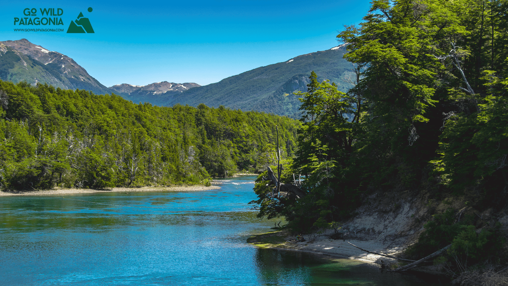
Pumalín Park is Doug Tompkins' original and most personal conservation project—325,000 hectares (800,000 acres) of pristine temperate rainforest donated to Chile in 2017, now a national park bearing his name posthumously. Founded in 1991 when Tompkins (North Face and Esprit founder) began purchasing degraded forest land in northern Patagonia, the park protects the world's southernmost temperate rainforest: ancient alerce trees (some 3,000+ years old), rivers cascading through moss-draped forests, volcanic peaks including active Volcán Michinmahuida, and fjords where dolphins swim. Unlike Argentina's accessible parks, Pumalín feels genuinely remote—accessed only by ferry or rough gravel roads, with infrastructure purposefully minimal to preserve wilderness character. Tompkins' vision combined strict conservation with thoughtful tourism: beautifully designed campgrounds with covered shelters and hot showers, interpretive trails explaining forest ecology, and organic farm showcasing sustainable agriculture. After his death in 2015, the park became cornerstone of Chile's Route of Parks—a 1,700-mile network of 17 national parks he helped create. Visiting Pumalín feels like entering a cathedral of trees—humbling, peaceful, and testament to what private conservation can achieve.
Why Visit
Walk among ancient alerce trees — The Sendero Alerces trail leads through groves of these 3,000+ year-old giants (Patagonian cypress—Fitzroya cupressoides). Their massive trunks (up to 4m diameter) and towering heights (60m) rival California's redwoods.
Experience Doug Tompkins' conservation legacy — Pumalín was the foundation for Tompkins Conservation's work. Visitors witness his philosophy: rewilding damaged land, creating infrastructure that serves rather than dominates nature, inspiring others through example.
Hike pristine rainforest trails — Temperate rainforest unlike anywhere else: ferns carpeting forest floor, coihue and tepa trees draped in moss, bamboo (colihue) creating green tunnels, rivers plunging over waterfalls.
Camp in beautifully designed campgrounds — Tompkins insisted on architecture that honors landscape. Campgrounds feature covered cooking shelters with wood stoves, immaculate facilities, hot showers (rare in Patagonia camping), thoughtful design using local materials.
Witness volcanic landscapes — Volcán Michinmahuida (2,404m) and Volcán Chaitén (1,122m—violently erupted 2008) provide dramatic backdrop. Trails lead to lava fields, volcanic valleys, hot springs.
Support conservation tourism — Visiting directly supports park operations and demonstrates value of protected wilderness to Chilean government and local communities.
Getting There
By Ferry (Most Common):
Hornopirén → Caleta Gonzalo: Ferry crosses Gulf of Ancud (4-5 hours). Scenic journey through fjords. Companies: Tabsa, Somarco. Cost: ~$100-150 per vehicle + $10-15 per passenger. Schedule: Several weekly December-March; reduced April-November. Booking: Essential 1-2 weeks ahead summer; www.tabsa.cl. Ferry is half the adventure—dolphins, sea birds, glacier views.
Caleta Gonzalo: Park's northern entrance and main base. Campgrounds, visitor center, trails.
By Road (Adventurous):
From Chaitén (South): 60 km north on Carretera Austral (gravel, rough sections). Chaitén accessible by ferry from mainland or overland from Argentina via Futaleufú. Challenge: Road passes active volcanic zones (Chaitén erupted 2008), washouts possible, 4WD recommended.
Overland Through Park: Carretera Austral traverses park south to north (60 km section). Spectacular but slow—allow 2-3 hours for short distance.
No Public Transport: Must have own vehicle or join tour. Hitchhiking possible summer (locals and tourists travel Carretera), but don't rely on it.
Planning: Most visitors include Pumalín as part of Carretera Austral road trip—typically Puerto Montt → ferry → Pumalín → south to Chaitén and beyond.
Top Experiences
Sendero Alerces (Ancient Alerce Trail) — The park's signature hike. Stats: 2 km loop (1 hour), easy, boardwalk sections. Trailhead: Caleta Gonzalo area. Experience: Walk among alerce giants—3,000+ year-old trees with massive cinnamon-colored trunks. When these trees sprouted, Ancient Rome was a village. Interpretive signs explain alerce ecology: slow growth (1mm/year diameter), fire-resistant bark, cultural significance (Chilean national monument—cutting prohibited). Atmosphere: Cathedral-like—sunlight filtering through canopy, moss covering everything, silence broken only by bird calls. Photography: Difficult (low light), but magical. Wide angle for scale, tripod essential. Best time: Morning (fewer people, soft light).
Cascadas Escondidas (Hidden Waterfalls Trail) — More challenging rainforest hike. Stats: 4 km round trip (2-3 hours), moderate, elevation gain 200m. Trailhead: Near Caleta Gonzalo campgrounds. Route: Climbs through dense forest—coihue trees, bamboo thickets, ferns. Crosses streams on wooden bridges. Waterfalls: Three cascades at intervals. First two modest; final cascade (Salto Mayor) drops 30+ meters into pool. Can get close—mist refreshing. Wildlife: Chucao birds (distinctive call), woodpeckers, hummingbirds. Difficulty: Muddy after rain (always), slippery roots, moderate cardio. Good boots essential. Rewarding: Fewer hikers than Alerces trail, beautiful waterfalls, deep forest immersion.
Sendero Volcán Michimahuida — Multi-day mountaineering expedition (expert only). Summit: 2,404m active stratovolcano. Route: 3-4 days round trip, technical climbing (glacier travel, crevasses, ice slopes), only for experienced mountaineers with full equipment. Permits: Required from park office. Logistics: Typically hire local guides. Reward: One of Chile's most spectacular volcanic summits—360° views across forest, fjords, Northern Ice Field. Season: January-March only. Most visitors admire from distance.
Caleta Gonzalo Area Exploration — Even without long hikes, the area rewards exploration. Visitor Center: Excellent exhibits on Tompkins Conservation, park ecology, alerce forestry history, Doug's vision. Organic Farm (Fundo Pillán): Working farm demonstrating sustainable agriculture. Free-range cattle, organic vegetables. Walking paths. Beach: Caleta Gonzalo sits on cove—beach walks, tide pools. Short trails: Multiple easy walks near campgrounds—forest, shoreline, meadows.
Sendero Laguna Tronador — Day hike to glacial lake. Stats: 10 km round trip (5-6 hours), moderate-strenuous, 400m gain. Trailhead: South of Caleta Gonzalo. Route: Climbs through forest to alpine lake beneath Tronador peaks. Reward: Turquoise glacial water, mountain reflection, solitude (less visited). Bring: Lunch, layers (alpine zone colder), rain gear.
Camping at Pumalín — Signature experience. Campgrounds: Three main sites (Caleta Gonzalo, El Volcán, others)—all feature Tompkins' thoughtful design. Covered shelters: Communal cooking areas with wood-burning stoves, tables, benches—weatherproof. Facilities: Immaculate bathrooms, hot showers (coin-operated), sinks for dish washing. Sites: Organized platforms for tents, some with roofs. Cost: ~$15-20 USD per site (very reasonable for quality). Aesthetic: Beautiful—local wood construction, integrate with forest. Atmosphere: Peaceful, respectful fellow campers (conservation-minded travelers). Reservations: Not required but arrive early January-February.
Volcano Viewing — Two volcanic giants visible from park. Volcán Michinmahuida: Active stratovolcano, perfect cone, usually cloud-covered. Clear days reveal glacier-clad peak. Volcán Chaitén: To south—catastrophically erupted May 2008, burying town of Chaitén. Now dormant but landscape scarred. Drive through lava fields, ash-covered forests. Viewpoints: Multiple along roads and trails. Binoculars enhance.
Río Gonzalo & River Valleys — Crystal-clear rivers throughout park. Fishing: Trout present but catch-and-release only in most areas. Bring license (required). Photography: Turquoise water, moss-covered rocks, forest backdrop. Picnicking: Riverside spots perfect for lunch.
Sector El Amarillo (Southern Park Section) — Less visited area south of Caleta Gonzalo. Hot Springs: Termas El Amarillo—natural pools, rustic (bring towel). Access via trail. Trails: Multiple day hikes, fewer people. Access: Via Carretera Austral. Can camp here (basic sites).
Flora & Fauna Observation — Biodiversity hotspot. Trees: Alerce, coihue, tepa, canelo, arrayán, Chilean firebush. Understory: Ferns (dozens of species), bamboo (colihue), mosses, liverworts. Birds: Chucao tapaculo (song distinctive), Magellanic woodpecker (huge, spectacular), hummingbirds, parakeets, raptors. Mammals: Pudú (miniature deer—rare, dawn/dusk), foxes, river otters, bats. Aquatic: River dolphins occasional in fjords. Bring: Field guides, binoculars, patience.
Photography Workshop Opportunities — Park occasionally hosts workshops—landscape, macro (ferns, mosses), wildlife. Check Pumalín website or Tompkins Conservation. Stunning location for photography: ancient trees, waterfalls, volcanic backdrops, rainforest details.
Where to Stay
Inside Park (Camping):
Camping Caleta Gonzalo: Main campground, covered shelters, hot showers, 30+ sites (~$15-20 per site). Near trails, visitor center, beach.
Camping El Volcán: Smaller, similar facilities, quieter (~$15-20).
Free camping: Some designated backcountry sites (register with rangers). Minimal facilities.
Cabañas (Caleta Gonzalo):
Cabañas Caleta Gonzalo: Six cabins, 4-6 person capacity, fully equipped kitchens, woodstoves, beautiful design (~$120-180 per cabin). Booking: Well ahead—limited availability. Website: www.parquepumalin.cl
Outside Park:
Chaitén (60 km south): Town rebuilt after 2008 eruption. Basic hospedajes ($30-50), Hostel Pumalín ($20 dorms), camping. Services: supermarket, gas, mechanics. Staging point for entering park from south.
Hornopirén (Ferry departure): Simple hospedajes (~$30-50), camping. Overnight here before morning ferry.
Nearby:
Termas del Volcán: Near Hornopirén—hot springs, basic lodging (~$40-60).
Best Time to Visit
December-February (Summer Peak): Best weather (though rain still possible—this is rainforest!). Temps 12-20°C days, 5-10°C nights. Longest daylight (5 AM-11 PM). All facilities fully operational. Ferry schedules most frequent. Trails driest (relatively—mud perpetual). Campgrounds busiest (still not crowded by normal standards). Flowering plants, active wildlife. Best for families, first-time visitors. Book cabañas 2-3 months ahead; camping first-come.
March-April (Autumn): Shoulder season. Fewer visitors, autumn colors beginning (though evergreen rainforest doesn't change dramatically). Temps 10-16°C, rain increasing. Services still open through March; April some closures. Ferry schedules reduce. Good for solitude seekers, photographers (moody light). Lower accommodation prices outside park.
May-November (Wetter Season): Off-season but park accessible year-round. Heavy rain (this is wettest part of Chile—4-6 meters annual rainfall!). Cold (5-12°C days, near freezing nights). Short days. Trails extremely muddy. Ferry schedules minimal, sometimes cancelled storms. However: For hardy adventurers, winter offers complete solitude, dramatic storms, snow-capped volcanoes, lush greens enhanced by rain. Campgrounds open (few takers). Very quiet. Bring excellent rain gear, warm layers, flexibility. Best months: October-November (spring—improving weather, services reopening, wildflowers).
Sample Itineraries
2-Day Itinerary (Quick Visit)
Day 1:
Morning: Board ferry Hornopirén → Caleta Gonzalo (depart 8-9 AM)
Arrive Caleta Gonzalo early afternoon (1-2 PM)
Set up camp or check into cabaña
Afternoon: Sendero Alerces (ancient tree trail—1 hr)
Visitor center exploration
Evening: Cook in covered shelter, campfire
Sleep: Camping Caleta Gonzalo
Day 2:
Morning: Cascadas Escondidas hike (2-3 hrs)
Three hidden waterfalls
Midday: Pack up, lunch
Afternoon: Drive south on Carretera Austral (if continuing journey) or explore El Amarillo sector
OR: Stay another night (recommended if time allows)
4-Day Itinerary (Thorough Exploration)
Day 1:
Ferry to Caleta Gonzalo (morning)
Afternoon arrival, camp setup
Sendero Alerces easy hike
Visitor center, organic farm
Evening: Settle in, plan days ahead
Day 2:
Full day: Sendero Laguna Tronador (10 km, 5-6 hrs)
Alpine lake, mountain views
Pack lunch for trail
Evening: Return to camp, hot shower, rest
Day 3:
Morning: Cascadas Escondidas (2-3 hrs)
Waterfall photography
Afternoon: Beach walk, tide pools
Explore Caleta Gonzalo cove
Evening: Cook communal dinner with fellow campers
Day 4:
Morning: Drive to El Amarillo sector
Termas El Amarillo hot springs soak
Lunch: Picnic riverside
Afternoon: Continue south on Carretera Austral toward Chaitén
OR: Return north via ferry
7-Day Itinerary (Complete Immersion + Context)
Day 1: Hornopirén → ferry → Caleta Gonzalo → camp setup → Alerces trail
Day 2: Cascadas Escondidas hike → visitor center deep dive → organic farm tour → beach exploration
Day 3: Sendero Laguna Tronador full-day hike → alpine lake → return
Day 4: Rest/rain day (bring books!) → short walks → photography around campground → hot shower → cook elaborate camp meal
Day 5: Drive to El Amarillo sector → hot springs → explore southern park trails → camp El Amarillo or return Caleta Gonzalo
Day 6: Volcano viewing drive → Chaitén lava fields → town visit (rebuilt after eruption—interesting) → return park
Day 7: Morning final hike (revisit favorite trail) → pack up → depart south on Carretera Austral continuing journey
Where to Go Next
1. Carretera Austral South — Continuing the Road Journey
Distance: Immediately adjacent; park straddles Carretera Austral
Transport: Drive south from Pumalín on Carretera Austral (Route 7)
Why Go: Pumalín is logical first stop on Carretera Austral journey from north. Continue south to: Chaitén (60 km): Town rebuilt after 2008 volcanic eruption—walking through recovery. Puyuhuapi (150 km): German village, hot springs (Termas Ventisquero). Queulat National Park (200 km): Hanging Glacier (Ventisquero Colgante)—spectacular ice suspended on cliff. Coyhaique (400 km): Regional capital, resupply, gateway to Laguna San Rafael. Puerto Río Tranquilo (600 km): Marble Caves. Carretera Austral is ultimate road journey—Pumalín perfectly begins it. Budget 14-21 days for complete route.
Suggested Duration: 14-21 days for full Carretera Austral journey.
2. Futaleufú — Whitewater Adventure
Distance: 150 km southeast (3-4 hours via Chaitén and Villa Santa Lucía junction)
Transport:
Drive: South from Pumalín to Chaitén, then east toward Argentina border, turnoff to Futaleufú
Logistics: Requires detour from main Carretera Austral route
Why Go: Pivot from peaceful rainforest to adrenaline capital. Futaleufú River ranks among world's best whitewater—consistent Class IV-V rapids, turquoise water, stunning canyon. Multi-day rafting expeditions (~$800-1,200 USD, 2-5 days) camp on river beaches. Also kayaking, fly fishing (trophy trout), mountain biking, horseback riding, access to Patagonia Park. Perfect contrast: Pumalín's tranquil forests → Futaleufú's whitewater excitement. Budget 3-5 days for rafting; 5-7 days for multiple activities.
Suggested Duration: 3-7 days depending on activities.
3. Chiloé Island — Cultural & Wildlife Contrast
Distance: 100 km north (ferry from Hornopirén region back toward mainland, then to Chiloé)
Transport:
Ferry: Multiple crossings required. Retrace to mainland via Hornopirén ferry system.
Drive: Once on mainland, drive to Chiloé ferry at Pargua (frequent crossings, 30 min)
Why Go: Complete tonal shift from wilderness to culture/wildlife. Chiloé: UNESCO World Heritage wooden churches (palafitos), unique architecture, mystical folklore, distinct gastronomy (curanto—seafood cooked in earth oven), penguin colonies (Puñihuil—Humboldt and Magellanic together—rare!), national parks (Chiloé NP—temperate forest, beaches). After Pumalín's solitude, Chiloé offers cultural richness, easier logistics, different landscapes. Creates balanced journey: nature + culture. Budget 3-5 days.
Suggested Duration: 3-5 days for Chiloé highlights.
4. Puerto Varas & Lake District
Distance: 200 km north (4-5 hours from Hornopirén region)
Transport:
Drive: North via ferry system to mainland, then highway to Puerto Varas
Bus: Services connect Hornopirén region to Puerto Varas (with connections)
Why Go: Transition to accessible, comfortable Lake District. Puerto Varas: German-influenced town on Lago Llanquihue, Osorno Volcano views, chocolate shops, sophisticated dining, comfortable hotels. Activities: Vicente Pérez Rosales National Park (Petrohué Falls, Todos Los Santos Lake), Osorno Volcano climb/ski, Frutillar (German heritage town), Puerto Montt gateway.
Why Go: Transition to accessible, comfortable Lake District. Puerto Varas: German-influenced town on Lago Llanquihue, Osorno Volcano views, chocolate shops, sophisticated dining, comfortable hotels. Activities: Vicente Pérez Rosales National Park (Petrohué Falls, Todos Los Santos Lake), Osorno Volcano climb/ski, Frutillar (German heritage town), Puerto Montt gateway. After rugged Pumalín camping, Puerto Varas offers civilization comforts—hot showers, restaurants, wifi, gear replacement. Good decompression before returning Santiago or continuing adventures. Budget 3-5 days.
Suggested Duration: 3-5 days for Lake District.
Planning Your Route:
Classic Carretera Austral Start: Puerto Montt → ferry Hornopirén → Pumalín (3-4 days) → Carretera Austral south → Queulat → Coyhaique → continue south or return
Conservation-Focused Journey: Pumalín (4 days) → Futaleufú → Patagonia Park (3 days—Tompkins' other project) → explore Route of Parks concept
North Patagonia Loop: Puerto Varas → Pumalín → Carretera Austral → Futaleufú → cross to Argentina → Bariloche → return Puerto Montt
Quick Immersion: Fly Puerto Montt → drive to Hornopirén → ferry → Pumalín (3-4 days camping) → return ferry → fly Santiago. Perfect week escape.
Timing Tips:
December-February offers best weather for camping and hiking
Book ferry 1-2 weeks ahead for summer (Dec-Feb)
Cabañas require 2-3 months advance booking
Build flexibility—weather can delay ferries
Budget minimum 2-3 days; 4-5 days ideal for thorough exploration
Bring rain gear regardless of season—this is temperate rainforest
Winter (May-Nov) requires serious preparation but rewards with solitude
Combine with Carretera Austral road trip for complete Chilean Patagonia experience
Support park by camping, buying at organic farm, respecting Leave No Trace principles# Parque Nacional Pumalín Douglas Tompkins
About Me
Veb
Hey there! I’m Veb and I've traveled solo and in groups for 10+ years in Patagonia - across Chile and Argentina.
I started Go Wild Patagonia with a desire to help other travelers plan their journeys in Patagonia with a focus on adventure, nature and being in the wilderness.
Say Thanks
Support my mission to make Patagonia more accessible for travelers while supporting local tour operators who organize only sustainable travels in Patagonia.
Read More
Chubut Province, Argentina — Cathedral of Ancient Trees Overview Los Alerces National Park protects 263,000 hectares of pristine Valdivian rainforest in Argentine Patagonia, home to some of the oldest living trees on Earth. The park's namesake—the alerce tree (Fitzroya cupressoides)—can live over 3,000 years, rivaling California's sequoias and bristlecone pines.
Update on Oct 24, 2025

El Bolsón offers world-class hiking: Refugio Hielo Azul and Refugio Cajón del Azul sit in alpine cirques accessible via multi-day treks, Cerro Piltriquitrón (2,284m) provides panoramic summit views, and Cajón del Azul's turquoise canyon ranks among Patagonia's most photographed day hikes.
Update on Oct 24, 2025

Monte Leon National Park is Argentina's first coastal national park, protecting 40 km of dramatic Atlantic shoreline where the Patagonian steppe meets the sea.
Update on Oct 24, 2025
